To strengthen transparency and regulatory compliance in watershed rehabilitation, Bharinto Mine in Indonesia developed SITANAM, a web-based and mobile application for individual plant-level geotagging and monitoring. This initiative supports regulatory requirements from the Financial Audit Agency and the Ministry of Environment and Forestry of the Republic of Indonesia, which require 100% geotagged photographic documentation.
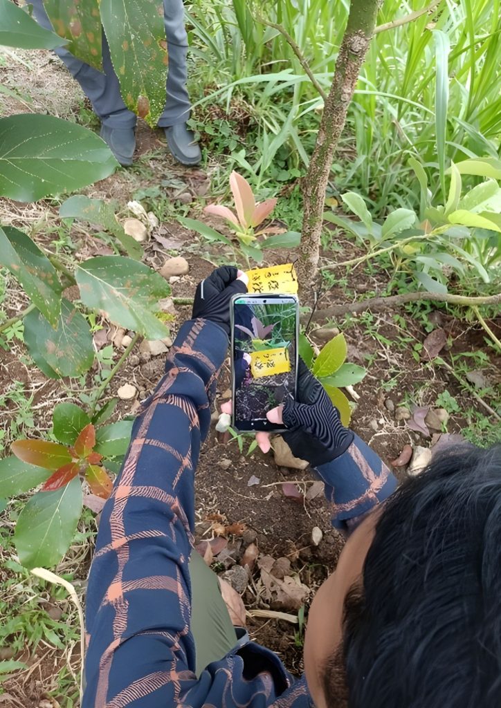
SITANAM improves the effectiveness of field monitoring by replacing manual approaches that relied on plot sampling and team-based observation. Through the system, each planted seeding is tagged with a barcode label linked to geolocation data, captured by a mobile device, and synchronized with a centralized cloud-based platform. The system also integrates unmanned aerial vehicles (UAVs) to support monitoring activities. By enabling real-time, plant-level monitoring, SITANAM strengthens monitoring, reporting, and verification (MRV) processes, supports regulatory compliance, enhances transparency and accountability, and supports measurable biodiversity outcomes and continuous improvement in watershed rehabilitation.
• Fullfilment of national laws and regulations
• Stakeholder engagement
• Cost savings related to workforce efficiency
• Enhanced planting data accuracy
• Enhanced geolocation accuracy
• Supporting Net Positive Impact on biodiversity
 English
  Thai
Thai